
Do you have a list of hundreds of addresses and need their coordinates? Or perhaps you have GPS points and want to know which addresses they correspond to? LiKoToN Google Geocoder is a lightweight web application that does exactly that in just a few clicks, without writing scripts or installing anything on the user’s computer.
What it does?
The application uses the Google Geocoding API and supports both directions:
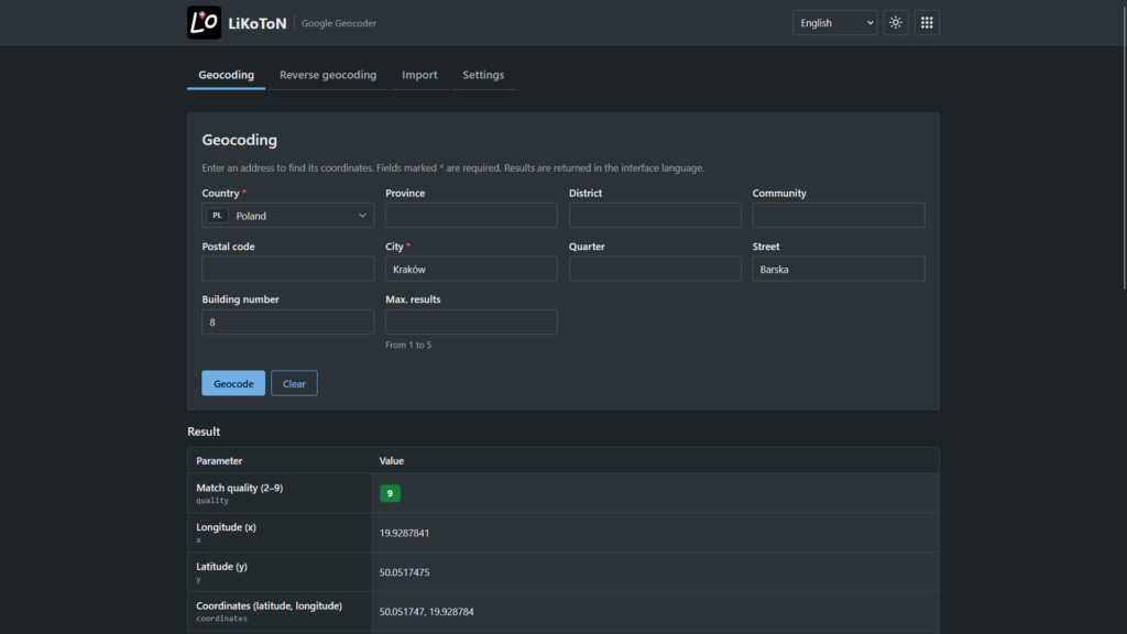
- Geocoding converts an address into coordinates. Enter a country, city, street, and house number (only country and city are required), and you will receive latitude, longitude, and a formatted address in the interface language.
- Reverse geocoding converts coordinates into an address. You can narrow the results using Google filters such as result type (for example, streets only or cities only) and location type.
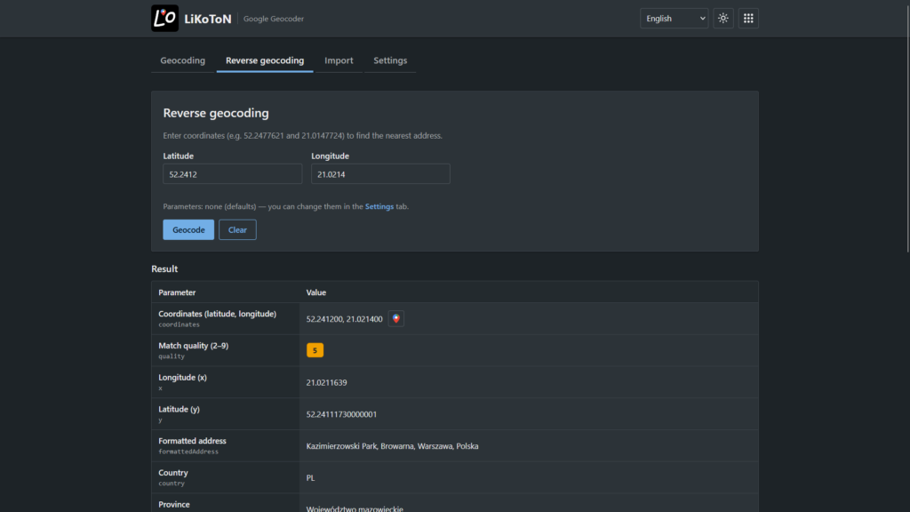
The result of every query can be viewed immediately on a Google map embedded directly in the application window.
Process entire files instead of individual addresses
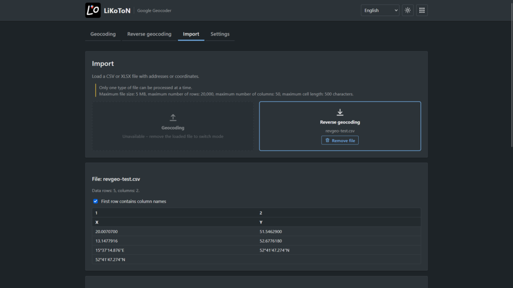
The biggest time saver is the Import tab. Load a CSV or XLSX file, select the columns containing addresses (or coordinates), and the application processes all rows automatically. Before sending requests, it validates the data and highlights invalid rows.
When processing is complete, you can review a quality summary and a table preview, then download the results as CSV, XLSX, or JSON.
Google’s API does not provide bulk geocoding requests, so the application server sends requests in parallel (a few at a time) while respecting the maximum number of requests per second. A single operation can process up to 100 records.
Easy-to-Understand Result Quality
Google returns location types with names such as ROOFTOP or RANGE_INTERPOLATED, which may not mean much to non-specialists. To make them easier to understand, the application translates them into plain language:
| In the application | |
|---|---|
| ROOFTOP | Exact address |
| RANGE_INTERPOLATED | Estimated address number along a street |
| GEOMETRIC_CENTER | Center of a street or area |
| APPROXIMATE | Approximate location |
Additionally, every result receives a quality score from 2 to 9, calculated from the location type and whether Google reported a partial match. The score is displayed as a colored badge, and hovering over it reveals a legend describing each quality level.
When importing thousands of addresses, you can immediately see how many are precise matches and how many require manual verification. Results with partial matches receive lower scores because Google did not fully match the query and the address should be reviewed.
Other fields are translated as well. For example, partial matching is displayed as Yes/No, and result types such as street_address or political are presented with user-friendly names.
Seven Languages
The interface is available in Polish, English, Czech, Slovak, German, French, and Spanish. Geocoding results returned by Google are displayed in the selected interface language.
Getting Started
You need your own API key from Google Cloud Console, with the Geocoding API enabled and billing activated. Without active billing, Google rejects requests even if the API key itself is valid.
The connection test button in the Settings tab immediately verifies whether the key is working correctly.
Map Integration and Google Terms
The Google Maps Platform Terms of Service allow geocoding results to be displayed only on Google Maps, which is why the application does not support any other map providers.
Summary
Google Geocoder is a fast and convenient way to convert addresses into coordinates and vice versa, whether you are working with a single query or large datasets. Beyond the coordinates themselves, it provides a clear reliability score for every result, immediate map access, and an interface available in seven languages.
Video
Version
- 1.0.0

Leave a Reply